
Walk a Palo Alto Street
The strongest Palo Alto street directory workflow starts with one exact civic address. A postal spelling can be normalized later, but the APN and legal description give the search a stable anchor. The sequence below moves from remote parcel evidence to the records that require a counter visit. It also keeps a listed occupant, a title holder, and a permit contact in separate categories.
- Check USPS when the street spelling or ZIP is uncertain, then enter the street number, street name, and unit in the Santa Clara County Assessor address search.
- Save the APN and situs address from the parcel response. Compare it with a Palo Alto Parcel Report before assuming the property is within city jurisdiction.
- Open Santa Clara County Discover GIS, search the address or APN, and click the parcel to inspect its pop-up and nearby boundaries.
- Take the APN, current names, and legal-description cues to the Clerk-Recorder. Search the current acquisition by name, address, APN, document number, or book and page.
- Read Palo Alto permit and planning records for dated work, then use library criss-cross directories when the question is about a past listed household.
This is the core address path: address to parcel, parcel to legal land, legal land to recorded parties, then records that add time and context.
Resolve a Palo Alto Address
The Santa Clara County Assessor property search accepts a street-number route or an APN route. The County’s address and APN lookup gateway points researchers to the same parcel path. Street Number is required for an address search. Street Name is an autocomplete or text field, Unit is optional, and City can narrow the result to Palo Alto. Preserve the digits and hyphens in an APN exactly as returned. If a name is missing from the public response, that is an access limitation, not evidence that the parcel has no owner.
| Search field | Type and use | Format note |
|---|---|---|
| Street Number | Required text for the address route | Numeric civic number |
| Street Name | Required text or autocomplete | Try the normalized city spelling |
| Unit | Optional text | Use when a condominium or unit is recognized |
| City | Optional filter | Palo Alto can narrow the result |
| APN | Alternative identifier | Keep digits and hyphens as instructed |
| Search / Reset | Buttons | Run or clear the query |
A parcel response can include APN, situs, class or use, land and improvement values, total assessed value, tax-rate area, subdivision cues, assessment year, and transfer or base-year details. The mailing address is where a tax notice goes. The situs is the land. Their match can be a clue about owner occupancy, but it does not identify every occupant.
Browse Palo Alto Parcels in Discover GIS
The county GIS viewer changes an address search from text into a reproducible map walk. Search by address or APN, zoom until parcel outlines appear, click the target, and note the pop-up attributes. Layers can add parcels, boundaries, planning or zoning context, aerials, and other available data. Basemap, zoom, pan, measure, and select controls help define the block, but no map tool turns a parcel into a household roll.
Click adjoining parcels one at a time and preserve each APN. A side or rear boundary and the lots across the street are geographic relationships, not proof that the named owner lives there. The Santa Clara County GIS viewer should be paired with Palo Alto Parcel Reports, which connect address or APN to planning and development facts.
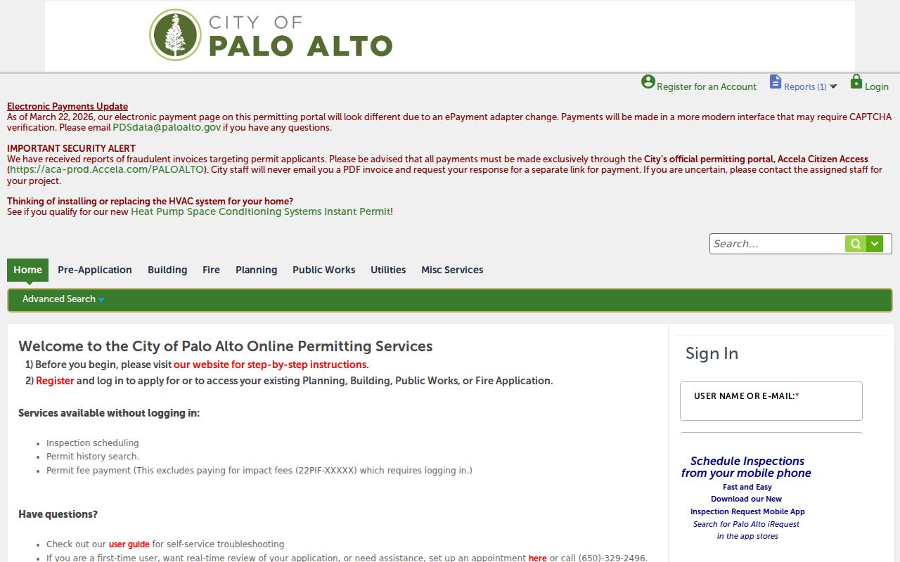
The city’s development search gives a second address-keyed channel. The Palo Alto Accela portal exposes record number, project name, street number, street name, unit, date range, and record type fields. Results may show project address, record number, description, status, application, issue or final dates, inspections, contacts, and linked documents.
A screen capture of the Accela search shows the address and date controls used to narrow a Palo Alto address trail.
Permit applicants and contractors are evidence of a project connection, not proof of residence. For older or restricted files, describe the address, record type, and date range in a City public-record request.
Palo Alto Street Records
An address search becomes useful when each record set is assigned a narrow role. The APN joins the assessor, map, permits, and deeds. A street name organizes a browse, but a legal description carries the land through address changes. The voter route is restricted, and the historical route depends on a dated volume.
| Address record | Keeper | What it shows | Access |
|---|---|---|---|
| Assessor parcel | Santa Clara County Assessor | APN, situs, values, class, mailing evidence | Address/APN search |
| Parcel geometry | County and city GIS | Boundaries, adjacent lots, layers | Free map viewer |
| Recorded deed | County Clerk-Recorder | Grantor, grantee, legal description, recording data | Counter and Digital Reel |
| Permit or code file | Palo Alto Planning and Development Services | Project, dates, status, named contacts | Accela or request |
| Criss-cross directory | Library, PAHA, or collection holder | Listed occupant or business by number | Onsite or scan, edition-specific |
| Voter data | Secretary of State / Registrar | Restricted geographic registration fields | Approved statutory purpose |
Use the source that matches the claim. A tax record can begin an ownership inquiry. A deed can show a transfer. A permit can date construction. A directory can show who was listed. None is a complete list of people at the address.
Turn a Parcel Into Santa Clara Deeds
Santa Clara County recorded-document research is chiefly an in-person task at 110 West Tasman Drive, first floor, San Jose. The office lists Monday through Friday hours of 8:00 a.m. to 4:30 p.m. and a research phone number of (408) 299-5688. Bring a name, address, APN, document number, or book and page. Staff do not provide a title-search service. The researcher operates the index and Digital Reel, then orders copies separately.
Start with the current acquisition. Capture recording date, document number or book and page, document type, grantors, grantees, legal-description cues, and image references. Move backward by searching the current grantor as an earlier grantee. Confirm each step with the APN or identical lot, block, tract, or subdivision description. A deed of trust, release, lien, or quitclaim has a different meaning from a deed that transfers title.
- Parcel
- The assessor’s administrative unit, identified by an APN and shown as a mapped piece of land.
- Situs address
- The civic location of the land or improvement, distinct from a tax mailing address.
- Plat
- A recorded map that lays out lots, blocks, streets, or a subdivision.
- Criss-cross directory
- An address-order directory that reverses an alphabetical name search and lists a number with a person or business.
For copies, certificates, recording, or other official services, use the Clerk-Recorder’s online and mail instructions. A library or archive can add context, but it cannot certify a current deed.
Map Palo Alto Permits Along a Street
Accela and city parcel reports add a municipal layer that the county deed index does not. Search by street number and name, record number, project name, date range, or module-specific record type. A result may include application or issue dates, final status, inspections, work description, parcel address, and links to documents. BuildingEye-style map filtering can group markers by address, area, ZIP code, neighborhood, planning district, or custom GIS layer when that view is available.
Permit records are best used as dates. A demolition, addition, conversion, or planning review can explain why a directory address looks different in a later year. The applicant or named contact may be an architect, contractor, business, or owner acting for the parcel. That name should be compared with the assessor and recorded documents before being treated as a resident clue.
Research note. Ask for records sufficient to show a defined permit, project, or code case over a date range. CPRA does not require the City to create a list of everyone connected to a street.
Read a Historic Palo Alto Street
The historical address path runs through Rinconada Library and the Palo Alto Historical Association. Mid- and late-century Haines or Polk-style reverse volumes may be filed as telephone or address directories, but the public shelf run is not fully published. Ask the reference desk or PAHA for a volume and year check. A criss-cross section moves from street to house number and can reveal a listed occupant, business, telephone, and nearby numbers for that edition.
Older Palo Alto searches also need the right place name. Mayfield was annexed in 1925. A south Palo Alto address can appear under Mayfield in an early directory, newspaper, map, or deed reference. Use APN ancestry, subdivision maps, and legal descriptions to bridge the place-name change. The full historical collection treatment is on the Palo Alto Directory Book page.
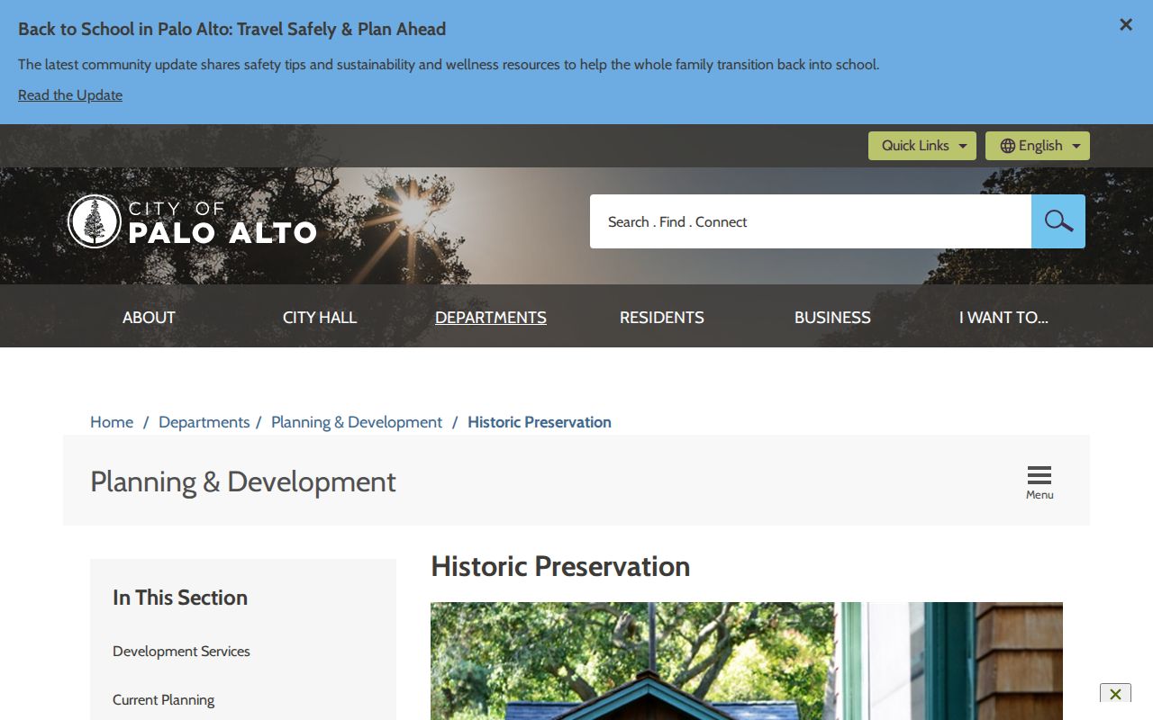
Historic-preservation material can add a parcel’s research context without replacing the directory. The City of Palo Alto historic-preservation resources connect surveys and property research to older buildings and neighborhoods.
Record the edition date, street spelling, house number, abbreviation key, and any owner or occupant code. A missing name may signal non-listing, a move, a changed number, or a gap in the publication.
Mayfield Names Still Matter on Older Streets
Palo Alto incorporated in 1894, while the older town of Mayfield joined it through the 1925 annexation. That history creates a practical address-history problem: an early newspaper or directory may use Mayfield even when a later parcel report uses Palo Alto. A literal modern street search can therefore miss the earlier record.
Search both place names in the library newspaper collection, directory catalog, subdivision material, and archival finding aids. Then compare the legal description, APN predecessors, lot and block, and neighboring landmarks. The object is not to force an old label into a modern one. It is to show why the same land appears under two civic names and to preserve the uncertainty when the parcel connection is not proven.
ZIP and City Boundaries Mislead Streets
USPS ZIP codes route mail. They do not draw the City of Palo Alto boundary. ZIP 94303 can cross the everyday Palo Alto and East Palo Alto conversation, while 94305 is tied chiefly to Stanford. Stanford, East Palo Alto, Menlo Park, and county edge conditions can send a request to the wrong custodian if the researcher relies on a postal city alone.
Verify the exact address with USPS, then confirm the parcel and jurisdiction in city reports or GIS. The county assessor and recorder follow the land and record, while the court follows venue and vital records follow the event. When a street appears to cross a boundary, split the search by parcel rather than treating one ZIP as a single residents directory.
Palo Alto Street Directory Limits
A Palo Alto street directory can expose an owner clue, a legal transfer, a permit contact, a mapped parcel, or a historical listing. It cannot reliably enumerate every person who occupies a building. Utility customer information and DMV addresses are not public directory fields. Trusts, LLCs, off-site mailing addresses, protected participants, unlisted adults, children, and changed names can all break a simple address-to-person assumption.
Voter information is not a workaround. My Voter Status is a private self-check, and a fuller county file requires a certified purpose under Elections Code section 2194. Safe at Home can shield a participant’s address. Sealed court files, confidential vital records, and redacted police material remain closed even when a parcel is easy to map.
Lawful use. Use Palo Alto street and address records for personal, lawful research, family history, civic understanding, and document verification. Do not use a record to stalk, harass, intimidate, impersonate, or harm anyone.
When the goal shifts from a whole street to one identity, use the Palo Alto resident lookup workflow and require two independent identifiers before connecting names.